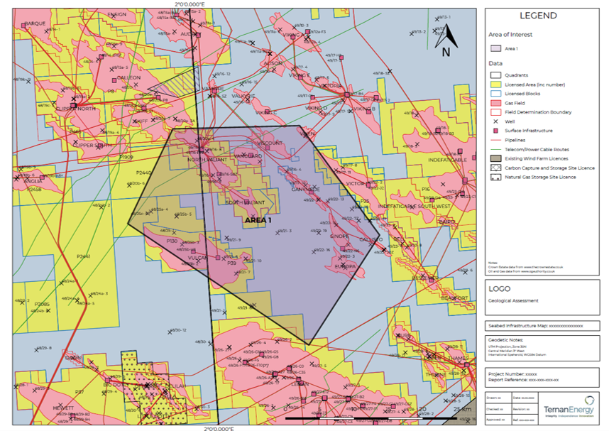
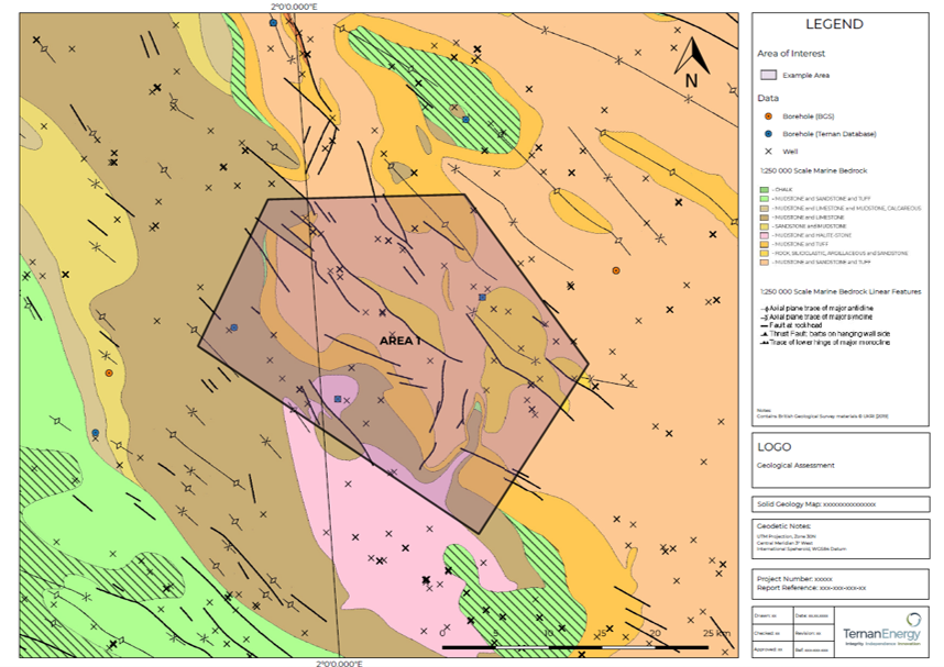
Using GIS to Optimise Site Selection
Ternan Energy has been engaged to conduct geological and geohazard screening of potential offshore development zones for both the oil & gas and renewables sectors to support our Client’s site selection process.
All data was incorporated into a GIS project and presented as a number of site-specific drawings detailing the relevant information. Ternan has an established GIS capability for spatial analysis of data, survey planning and charting to assess potential seabed conditions and geohazards within the marine geoscience sector.